Bhutan (DRUKGEOID2022)
|
Authors: R. Fernandes, M. Bos
|
Created: 2022
|
Resp: Kinzang Thinley
|
| | Description:
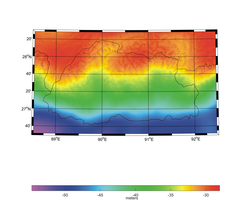
DRUKGEOID2022 is the official geoid model of Bhutan, covering the area from 88.5°E to 92.5°E in longitude and from 26.5°N to 28.5°N in latitude with a grid resolution of 0.02°. It is an update of the previous DRUKGEOID2015 model, that was changed by a bias of 0.8761 m. This update was due to the change of the reference benchmark from the TH01 station at NLC headquarters to the more reliable THIZ station belonging to the national zero-order GNSS/levelling network. In this way, the resulting geoid can be used for the conversion from ellipsoidal heights in the DRUKREF03 system (ITRF2000 at epoch 2003.87) to orthometric heights in the national vertical datum, which is in turns connected to the Indian mean sea level through the neighboring benchmarks in the Indian states of West Bengal and Assam. Comparison of 27 GNSS/levelling benchmarks with DRUKGEOID2022 showed a standard deviation of 0.55 m.
Model Citation:
|
|

